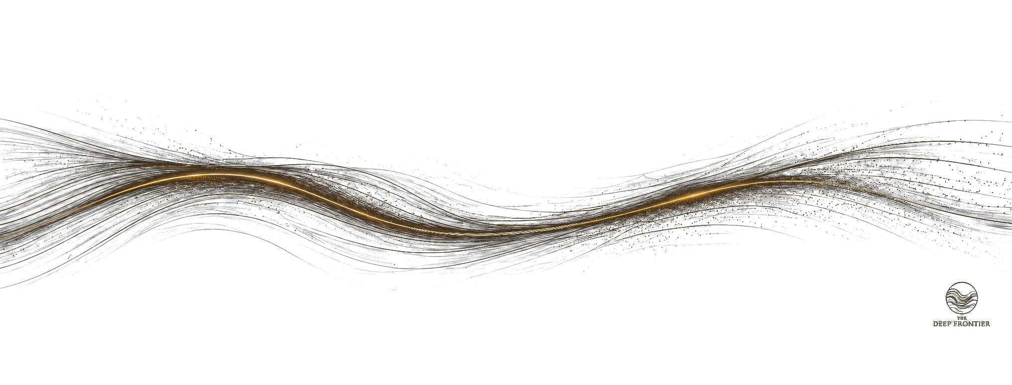
These are not geophysical data products.
They are resolved causal structure — corridor geometry, node concentration, transfer architecture, and structural organisation extracted from the gravitational field using Subterrane’s proprietary methodology and publicly accessible geophysical datasets.
The value is not in the file format. It is in knowing where the structure is.
Available Formats
GeoTIFF
SHP
GeoJSON
KML
PNG overlay
Metadata PDF
GeoTIFF and PNG overlay included in corridor packages. Vector formats available separately — see below.
Corridor Structural Packages
Each package contains: structural continuity overlay GeoTIFF · causal structure PNG overlay · structural metadata PDF · digital licence. Digital delivery on payment confirmation.
Western Mediterranean industrial corridor. Compressional duplex resolution. LNG terminal node zone. Dense concentration of Seveso seuil haut industrial infrastructure positioned across liquefaction-prone substrate. Documented across Dispatches 049–052.
GeoTIFF
PNG overlay
Metadata PDF
WGS84
Po Plain underground gas storage infrastructure node. Thrust fringe structural analysis. Documented in Dispatch 054.
GeoTIFF
PNG overlay
Metadata PDF
WGS84
→ Enquire
Italian system-scale sigmoid architecture. Po Valley piggyback basin sequence. Imbricated thrust front resolution. Documented in Dispatch 053.
GeoTIFF
PNG overlay
Metadata PDF
WGS84
→ Enquire
North Anatolian transfer architecture and Marmara extensional interior. Century-scale rupture sequence resolution. Bosporus continuity corridor. Istanbul node. Documented in Dispatch 056.
GeoTIFF
PNG overlay
Metadata PDF
WGS84
→ Enquire
4,000 km intraplate strike-slip system. En echelon magnetic architecture from Anza Graben through Madagascar. First resolved in 2017. Documented across the Deep Frontier corpus.
GeoTIFF
PNG overlay
Metadata PDF
WGS84
→ Enquire
Mosquitia–Patuca structural system. Cocos–Caribbean corridor resolution. 2015–2019 field programme. Compressional confinement, extensional interior accommodation, oblique transfer segmentation. Documented in Dispatch 045.
GeoTIFF
PNG overlay
Metadata PDF
WGS84
→ Enquire
All six corridor packages above. Single organisation licence. Full corpus as resolved to date.
All formats
All corridors
Single licence
→ Enquire
Causal Structure Vectors
The structural trajectory networks as usable GIS data. Compatible with QGIS, ArcGIS, and sovereign mapping environments. These are extracted structural organisation — not graphics.
Named structural trajectories, node positions, and transfer architecture for one corridor. Specify corridor on enquiry.
SHP
GeoJSON
KML
Metadata PDF
→ Enquire
Full western Mediterranean causal structure: Fos–Lavéra, Apennine system, Ferrara node, and connecting transfer architecture. Single regional dataset.
SHP
GeoJSON
KML
Metadata PDF
→ Enquire
Complete causal structural network across all resolved corridors to date. All named trajectories, nodes, and transfer architecture. Updated as corpus expands.
SHP
GeoJSON
KML
Metadata PDF
→ Enquire
Vector products are prepared on confirmed order. Delivery within 5 working days. Format and projection confirmed before preparation begins.
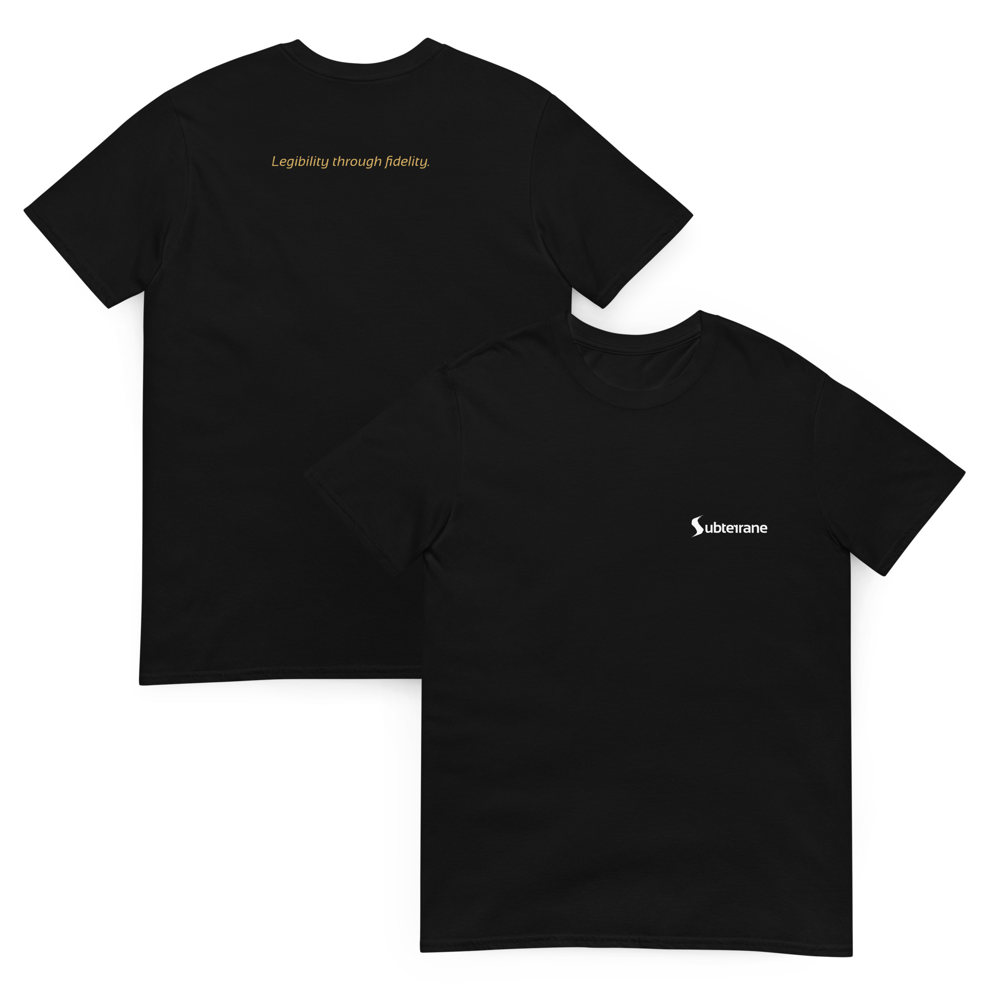
Physical Artifacts
The first physical artifact released under the Subterrane mark. Printed on demand via Printful. No inventory. No speculation.
Black t-shirt carrying the Subterrane mark and the doctrine phrase. Unisex fit. Gildan Softstyle. Shipped worldwide.
Black
S – 3XL
Printed on demand
Ships worldwide
→ Select size & order
Digital Licence — All Data Products
Single organisation use. No redistribution. No derivative commercial products. Not for input into AI training systems, LLMs, or commercial analysis engines. Internal use within the purchasing organisation only.
Licence is perpetual for the version delivered. Updates to resolved products are available at a discounted upgrade price.
Full licence terms provided with each product. Engagement proceeds under controlled commercial disclosure.
Corridor or node not listed?
Structural resolution for named assets, specific infrastructure corridors, or sovereign-scale systems is available on enquiry. CIM Phase 1 preparatory briefings can be arranged prior to product commissioning.
Contact: strategy@subterrane.info · sovereign@subterrane.info
IP Protection Notice
CIM, the Causality Lens™, Sigmoid Tectonics®, and the Nine Sovereign Instruments constitute proprietary intellectual property of Subterrane Holdings Ltd. The causal structural resolutions contained in Atlas products are derived from proprietary methodology applied to publicly accessible geophysical datasets. All rights reserved. Unauthorised redistribution, reproduction, or derivative commercial application is prohibited. Not for input into AI training systems. Engagement proceeds under controlled commercial disclosure.